
Natural and Culturo-Historical Region of Kotor
The Natural and Culturo-Historical Region of Kotor was the first property in Montenegro to be inscribed on the UNESCO World Heritage List. It was added in 1979, the same year in which a strong earthquake shook the Montenegrin coast, and it brings together the town of Kotor, the inner reaches of its bay and the historic settlements that line the shore. It is a rare example of a listing that treats a whole landscape — water, mountains, towns and fortifications — as a single protected whole.
Understanding what the listing actually covers helps a visitor see the bay differently. The protection is not only about one old town; it is about the relationship between the sea inlet, the steep limestone slopes around it and the communities that grew up along the water.
A bay that looks like a fjord
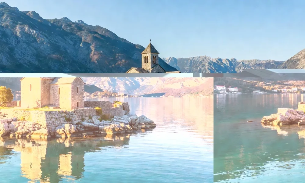
The Bay of Kotor, known locally as Boka Kotorska, cuts deep into the Dinaric mountains of the eastern Adriatic and is often described as Europe's southernmost fjord. Geologically it is not a fjord but a ria, a river valley that was drowned by the sea after the last ice age. The difference matters, because it explains the shape: a winding channel that narrows into passages and then opens into wider basins, all of it walled by high slopes that fall almost directly to the water.
This enclosed geography gave the region its strategic value and its distinctive architecture. Settlements cluster where a strip of flat land allows building, and the mountains above remained largely wild, forming a backdrop that is part of the protected property.
What the listing covers
The property is not a single monument but a mosaic. It includes the walled town of Kotor with its fortifications, the town of Perast with its baroque waterfront, the settlements of Risan, Dobrota, Prčanj and Stoliv, and the surrounding slopes. Together they represent centuries of maritime culture in which fishing, seafaring and trade shaped both the economy and the look of the towns.
Because the listing is cultural and landscape-based at the same time, the important qualities are the overall setting and the way the buildings sit in it. A single church or palace matters less than the pattern of a town pressed between mountain and sea, its squares small and shaded, its streets steep.
The town of Kotor and its walls
Kotor sits at the innermost point of the bay, where the water is calmest and the mountains close in. The old town is a compact maze of squares, lanes, churches and palazzi, enclosed by walls that climb the slope of the hill behind it. Those fortifications are among the most striking features of the region: from a distance the walls read as a long line of stone drawn up the mountain, with the ruins of a fortress at the top.
- The old town is small enough to cross on foot, but the lanes are easy to get lost in.
- The fortifications rise above the town and are reached by a steep path of steps.
- Several churches of different traditions sit within the walls, a reminder of the town's mixed maritime history.
- Maritime and craft museums explain the seafaring economy that built the region.
Perast, Risan and the smaller settlements
Perast, northwest of Kotor, is the clearest expression of the region's baroque period. It is a single street of stone houses and churches along the water, dominated by bell towers that were paid for by sea captains. Offshore lie two small islets, one of them with a church, which give the view the silhouette most photographs try to capture. Risan, at the far end of the bay, was a settlement in ancient times and preserves traces of that older history.
Dobrota, Prčanj and Stoliv are quieter, with long waterfronts of former captains' houses. They are part of the same protected region and help explain why the listing was drawn so widely.
Earthquake, danger list and recovery
The 1979 earthquake damaged much of the coast, and the new listing was placed on the List of World Heritage in Danger. This is a common fate for properties affected by natural disasters, and it signals that a site needs international attention and support. Over the following years the towns were repaired and consolidated, and the property was later removed from the danger list once its condition was judged stable.
That episode shapes how the region is understood today: as a place that survived a disaster and was rebuilt with care, rather than a frozen relic.
The region in brief
| Element | What it is | What to know |
|---|---|---|
| Listing | Natural and Culturo-Historical Region of Kotor | Inscribed in 1979 |
| Type | Cultural and landscape property | Whole bay, towns and slopes |
| Main towns | Kotor and Perast | Historic waterfront settlements |
| Setting | An enclosed Adriatic inlet | A drowned valley, not a true fjord |
| Why visit | Walls, churches, baroque architecture | Best explored on foot and by boat |
Visiting the region
The region is best approached slowly. Begin in Kotor, walk the old town, then climb part of the fortifications if the weather allows, because the view from above explains the geography better than any map. From there, a boat or a short drive along the shore leads to Perast and the smaller settlements, each with its own waterfront and its own quiet.
Because the property is a living place and not a museum, the ordinary rules of respect apply: keep to paths, mind the heat in summer, dress appropriately in churches and remember that the towns are home to people who live there all year. The listing protects the whole setting, and that setting is what a visitor comes to see.
Read next
Durmitor National Park World Heritage
Plateaus, glacial lakes and the Tara canyon inside a protected mountain massif.
Stećci: Medieval Tombstone Graveyards
A shared transnational listing of carved medieval tombstones found across the western Balkans.
Venetian Works of Defence in Kotor
The fortifications above the town, listed as part of a wider Venetian defence system.