
Durmitor National Park World Heritage

Durmitor National Park, in the north-west of Montenegro, was inscribed on the UNESCO World Heritage List in 1980. It protects a high mountain massif of limestone plateaus, forests, pastures and glacial lakes, and within its boundaries runs a stretch of the Tara canyon, one of the deepest river gorges in Europe. Together these features make the park both a natural monument and a working mountain landscape where people still graze livestock in summer.
The name Durmitor is usually taken to come from a Romance word for a sleeping place, a reminder that shepherds once moved with their flocks across these plateaus. Understanding the park means understanding altitude, weather and the slow rhythm of the seasons, because those shape everything a visitor experiences.
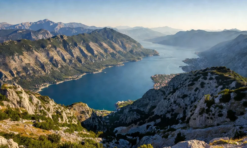
A massif of plateaus and peaks
Durmitor is not a single peak but a broad group of mountains, cut by canyons and dotted with summits. The highest point, Bobotov Kuk, rises above two thousand five hundred metres. Around it, the land opens into bare stony plateaus that can feel like a different world from the wooded valleys below, especially when cloud moves quickly across them.
The rock is largely limestone, a porous stone that drains surface water away and reappears far below as springs. This is why the plateaus look dry even when the surrounding region is green, and why water is a constant theme in the park's features.
Glacial lakes, the mountain eyes
The park contains a set of small lakes left behind by ancient glaciers. Locally they are called gorske oči, the mountain eyes, and about eighteen of them are counted within the massif. The best known is the Black Lake, close to the main resort area, which is easy to reach and popular for walking. Others lie higher and require a proper hike.
These lakes are cold, clear and shallow in places, with reed-fringed edges and forested shores. They are the reason the park draws walkers who are not aiming for the highest summits: a lakeside circuit offers big scenery without technical climbing.
The Tara canyon inside the park
The Tara river has cut a deep gorge through the limestone, and part of that canyon lies within the park. The water is famously clear and cold, fed by mountain springs and snowmelt. The canyon walls and the river below form one of the park's defining views, and rafting on the Tara is a long-established activity in the wider area.
- The river is fed by springs and snowmelt, so the water stays cold through the summer.
- The canyon is a protected zone, and access points are limited and controlled.
- Rafting is organised by local operators working within the area's rules.
- Viewpoints along the rim are reached by road, not only by trail.
Forests, pastures and wildlife
Below the bare rock, the park holds forests of beech, fir, pine and other species, some of them old and dense. Higher up, summer pastures open between the trees, and there is a long tradition of transhumance, the seasonal movement of livestock to mountain grazing. This mix of wild and working land is part of what the World Heritage listing recognises.
Wildlife includes large mammals and a rich bird community. As with any mountain park, animals are shy and best left undisturbed; sightings happen most often at quiet times of day and in the less-visited parts.
Weather and safety in the mountains
Mountain weather changes quickly. A clear morning can turn to cloud, wind and rain by afternoon, and the plateaus offer little shelter. Trails are marked, but some are long and demand fitness, proper footwear and a realistic sense of time. Snow lies on the high ground well into spring, and the passes can be closed.
Durmitor at a glance
| Feature | Description | Good to know |
|---|---|---|
| Status | Inscribed as World Heritage in 1980 | Natural property |
| Highest point | Bobotov Kuk | Above 2,500 m |
| Lakes | Glacial lakes, the mountain eyes | About eighteen within the massif |
| River | The Tara and its canyon | Among the deepest in Europe |
| Landscape | Rocky plateaus, forests, pastures | Altitudes near 1,500 m |
Getting there and staying
The park is reached by road from the towns of the north, and the main approach passes through the wider Durmitor area with its small settlements and resorts. Services are seasonal: in summer there are more places to stay and eat, and in winter the roads can be affected by snow. Because the park is large, the choice of base shapes the visit, and it is worth deciding in advance whether the aim is easy lakeside walking or a longer route into the high ground.
Supplies are limited once away from the main centres, so fuel, cash and food are best arranged before heading up. Mobile coverage can be patchy in the more remote parts, and the distances between trailheads are greater than they look on a map.
Visiting the park
Most visitors base themselves near the lakes and the main resort area, where the walking is gentlest and the roads are best. From there, longer routes lead into the plateaus and toward the higher summits. Whatever the plan, check conditions and park information first, carry water and layers, and tell someone where you are going.
Because the park is both protected and lived in, the simple rules matter: keep to marked paths, take all litter away, do not disturb livestock or wildlife, and remember that the landscape is someone's working summer pasture as well as a World Heritage property.
Read next
Natural and Culturo-Historical Region of Kotor
The first property in Montenegro inscribed by UNESCO, and why the bay and its towns were listed together.
Stećci: Medieval Tombstone Graveyards
A shared transnational listing of carved medieval tombstones found across the western Balkans.
Venetian Works of Defence in Kotor
The fortifications above the town, listed as part of a wider Venetian defence system.